Fostering Earth Observation Competence: Institute of Geography at International Remote Sensing Summer School (IRSSS) 2025 in Sardinia
- Ján Šašak
- Aug 6, 2025
- 1 min read

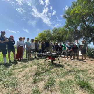
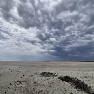
From July 21 to 25, 2025, the fourth edition of the International Remote Sensing Summer School (IRSSS 2025) took place in western Sardinia near the village of San Vero Milis. Research and educational activities were focused on the seasonally drying salt lake Stagno di Sal‘e Porcus, which—thanks to its geological specificity and unique stability of spectral properties—is emerging as a potential European calibration and validation site for data from hyperspectral satellite sensors.
The fourth edition of the summer school was co-organized with the National Institute of Geophysics and Volcanology (INGV), the Department of Chemical and Geological Sciences of the University of Cagliari (DSCG-UNICA), the Italian Association of Remote Sensing (AIT), and the Italian Space Agency (ASI).
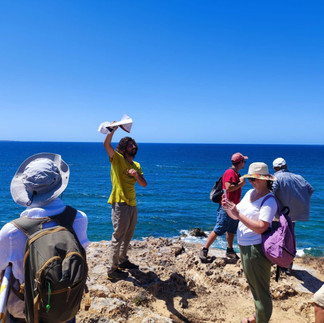
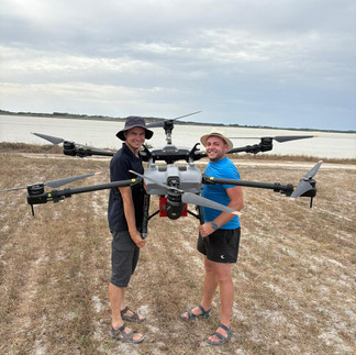
For the third time, staff from the Institute of Geography, Faculty of Science, Pavol Jozef Šafárik University in Košice—Assoc. Prof. Michal Gallay, Dr. Ján Šašak, and Dr. Katarína Onačillová—participated as invited lecturers. They led teaching blocks for master's and doctoral students from various international universities, focused on data collection and processing of laser and hyperspectral scanning obtained using our unmanned aerial system (UAS).
The participation of the UPJŠ team was supported by the ERASMUS+ program, and the research and teaching activities were carried out within the framework of the projects VEGA 1/0780/24: Combining lidar and hyperspectral data with machine learning methods to improve land cover classification, and KEGA 023UPJŠ-4/2025: Education in remote sensing focused on satellite and unmanned aerial platforms – development of a textbook and online study materials.